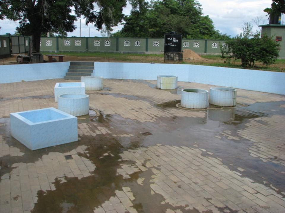
ARUGAM BAY
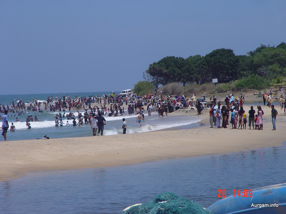
Arugam Bay is a bay situated on the Indian Ocean in the dry zone of Sri Lanka's southeast coast. The bay is located 320 km due east of Colombo. It is a popular surfing and tourist destination. Many of the buildings were destroyed in the 2004 tsunami. Due to its popularity among tourists, the area has managed a slow recovery by private initiatives only. As late as 2010 no help has been received from any official source or international organizations. An exception is uncoordinated support for fishing folk as well as many school rebuilding programs, resulting in a continuation to provide only separatist schools for each community. Although there is a huge demand for an international school, one huge new building donated by the people of Japan remains largely unoccupied since the grand 'opening' ceremony in 2007. (Distance - 78 Km from Ampara Town)
BUDDANGALA VIHARAYA
This Sri Lanka's oldest monastery (Buddangala) is situated in a mountain over 500 feet high. The Dagaba has been enshrined with the relics of Buddha and his two leading monks Seriyuth and Mugalan's remains. (Distance - 6 Km from Ampara Town)
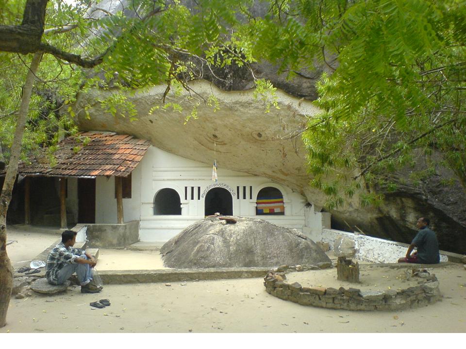
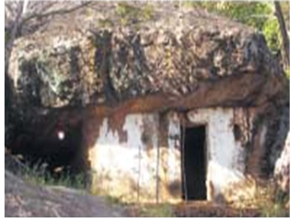
PIYANGALA
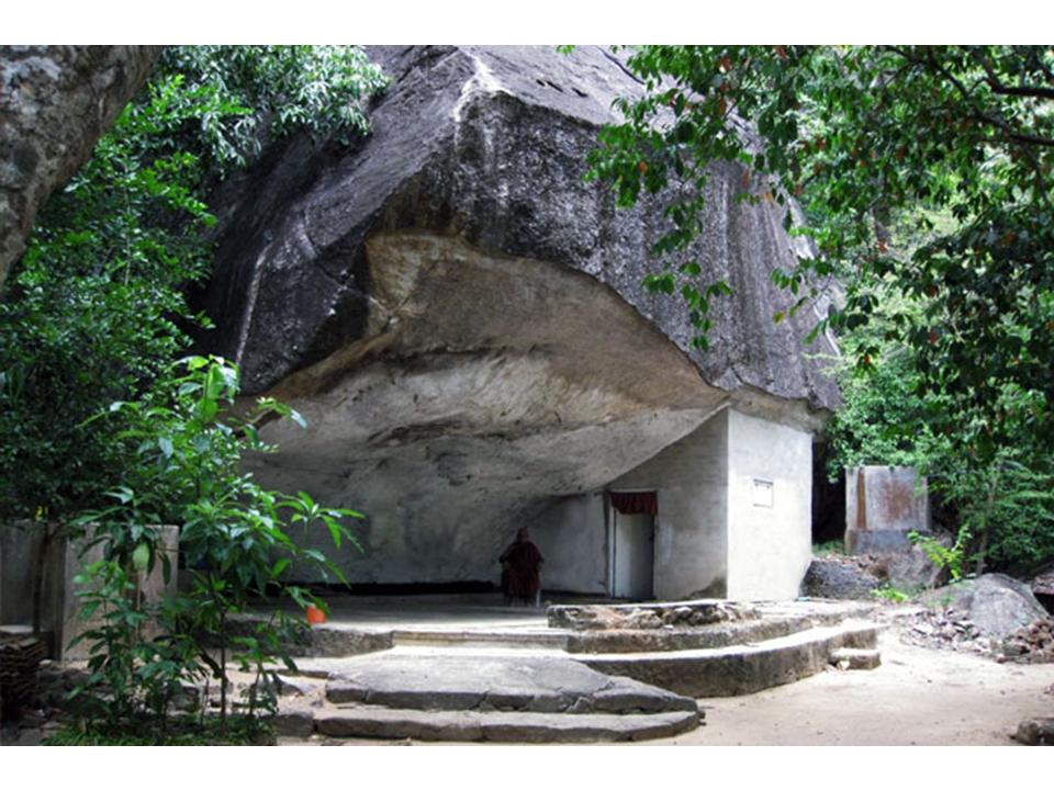
The historical Piyangala cave is world famous as the only cave in Sri Lanka with Veddha frescoes. The archeologically important cave is the property of the Department of Archeology at present. At present destruction of the cave by transporting granite from the cave to Oluwil port is taking place.
The villagers around the area have protested against the destruction and the ‘Organization to Protect Heritage of Digamadulla’ has carried out a massive campaign against the ravage of the historical cave. As a result of the campaign carried out by residents and ‘Organization to Protect Heritage of Digamadulla’ the Department of Archeology has promised to have a discussion regarding the matter on the 25th. They have been promised that fragmenting of stones would be stopped until a decision is reached at the discussion. (Distance - 12 Km from Ampara Town)
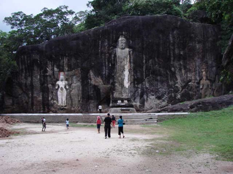
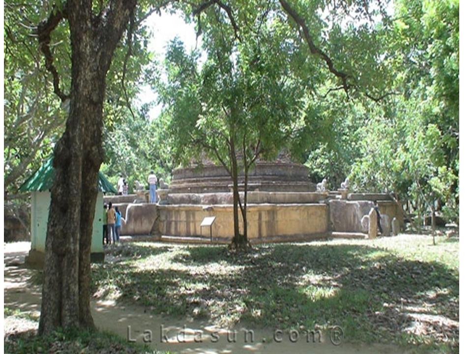
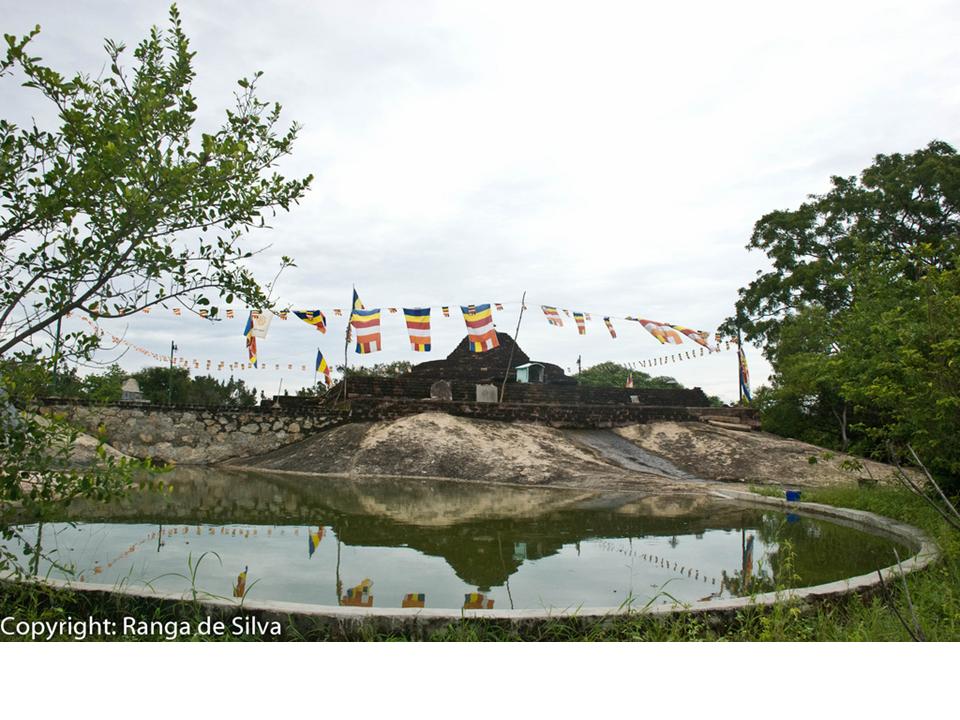
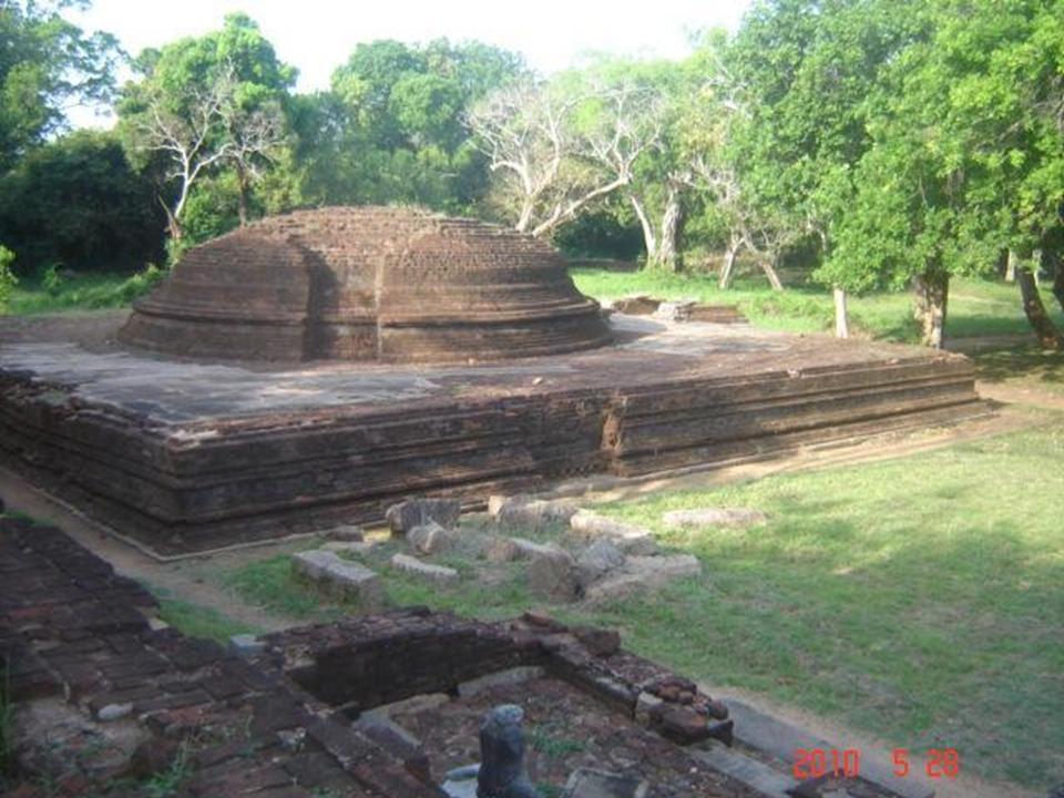
MAGUL MAHA VIHARA
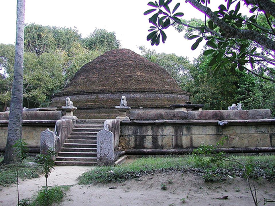
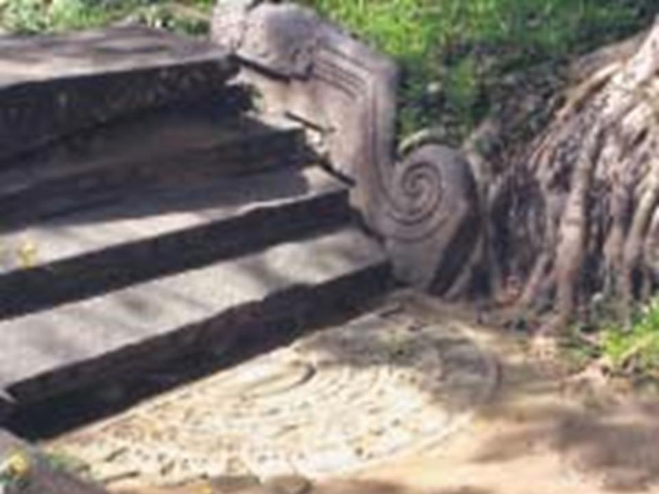
On the northern edge of the Lahugala National Park are the ruins of a substantial ancient temple now called Magul Maha Vihara. This temple is worth a visit not only because of its particularly attractive forest setting but also because the image shrine, the Bodhi Tree and the stupa are all in a good state of preservation. Magul Mahavihara is approached by a causeway across a beautiful lotus filled reservoir which surrounds the whole complex. As you enter the main gate through the solidly built wall that surrounds all the buildings you will see on the left the remains of a small shrine with an unusual moonstone at its entrance. The elephants on this moonstone all have riders on their backs, something unseen in all other Sri Lankan moonstones. The stupa is built on a high terrace with three staircases leading up to it. There are impressive lion guardians at the top of the stairs. These and all the other ruins at Lahugala are all surrounded by peaceful forest which makes a visit to the place a most enjoyable experience. (Distance - 6 Km from Pothuwil Town)
MUHUDU MAHA VIHARAYA
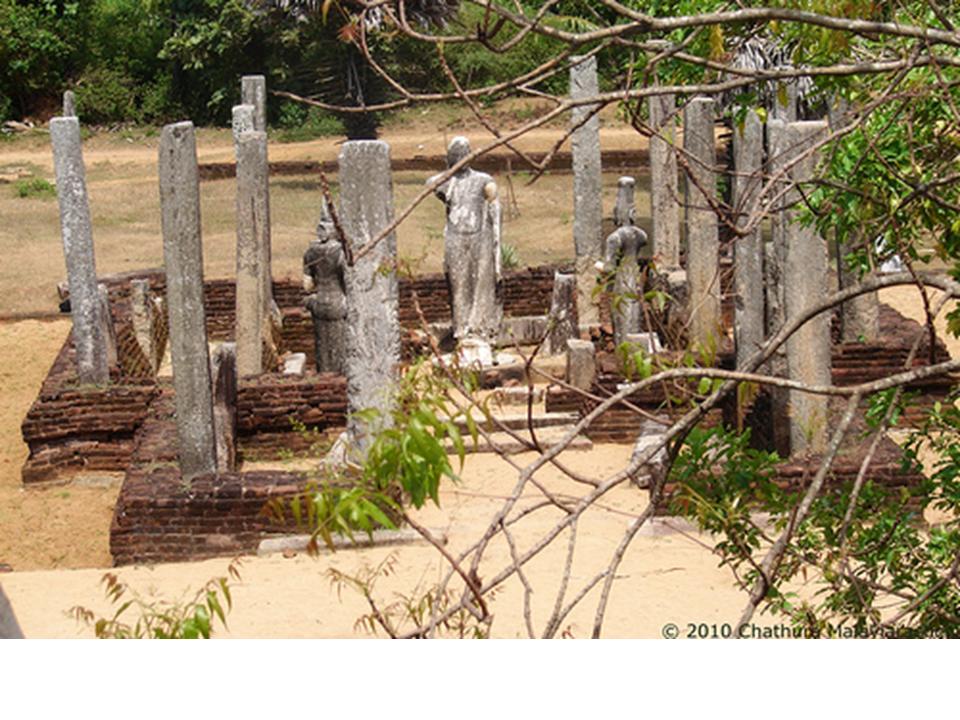
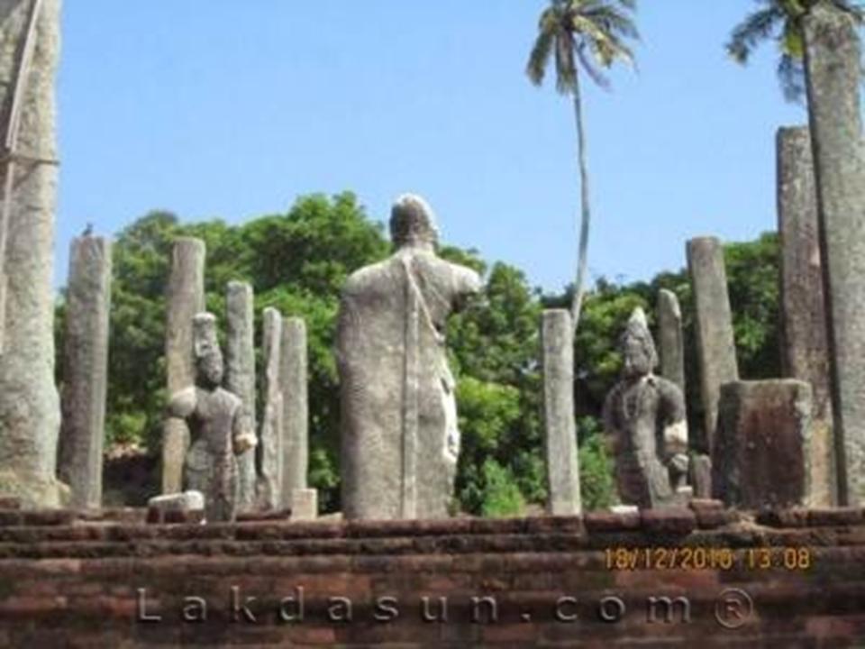
The Muhudu Maha Viharaya situated near Pottuville is over 2,000 years old. According to the resident monk, not much emphasis has been paid to protect this very ancient structure. There has been immense encroachment and much of this wonderful monument could be lost forever. Could it be that this Buddhist Monument is in the middle of a Muslim Community or the relevant authorities just don’t care. (Distance - 2 Km from Pothuwil Town)
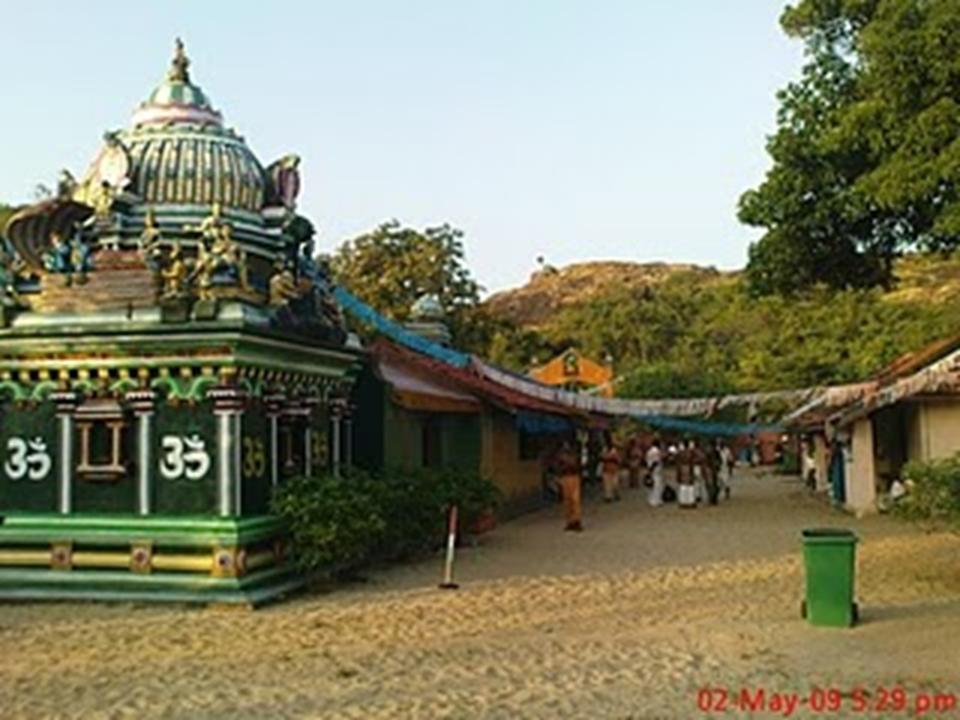
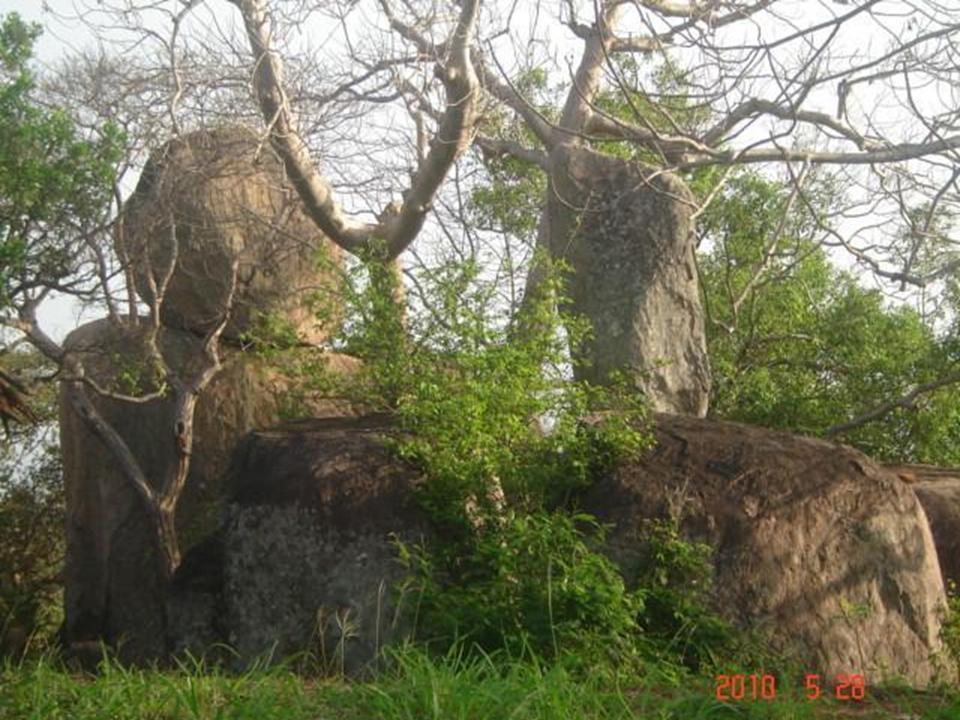
KUDUMBIGALA TEMPLE
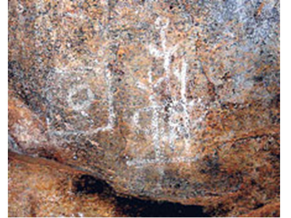
Panam Pattuwa is one of the most neglected areas of the Eastern Province. Kudumbigala, which is located in the Panam Pattuwa, is a hundred times worse.There is a thick jungle covering thousands of acres. No road worth its name runs through it. And in the middle, rising above the tree line is a rock. This is Kudumbigala. Resident in this vast area, almost totally devoid of human beings, are trees that would be unfamiliar to many. The trees and vines and the natural canopy their intertwining has produced, blots out the sky once you enter the jungle. There is a certain enchantment and coolness that accompanies anyone creeping through the thick foliage towards Kudumbigala. This is perhaps one reason why yogis of a bygone age chose this place to reflect on the eternal verities. Many of these blessed beings whose journey through sansara had seen them enter the irreversible process of liberation that comes with the securing of marga pala, we are told, reached the final stage of realisation in the monastic complex called Kudumbigala, made up of over 200 rock caves.
The inscriptions in brahmi script and other evidence in the recently discovered cave, Maha Sudharshana Lena, shows that Kudumbigala was established as an aranya senansanaya in the pre-Christian era. A stone inscription has it that the Maha Sudharshana Lena was built and gifted to the Arahats by Nandimitra Yodaya, one of King Dutugemunu’s “Dasa Maha Yodayas”. (Distance - 109 Km from Ampara Town)
THIRUKKOVIL
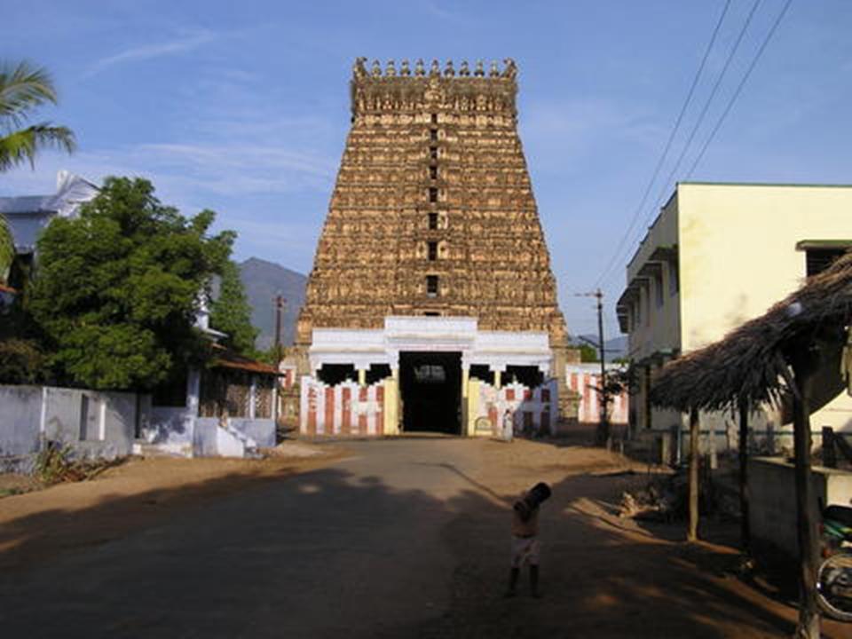
Thirukkovil or Tirukovil is a Town in the Ampara District of Sri Lanka, situated along the Eastern coast of the Island. It is located 30 km North of Pottuvil and 35 km south of Kalmunai. In Tamil it translates to God's-temple. It was affected by 2004 Indian Ocean tsunami.
It was under Batticaloa district and now under Ampara district. It is a famous place for the old Tamil cultures and Temples. It was severely affected by the Tsunami tidal waves of December 26, 2004. Because of the Tsunami, many people lost their relations and properties including houses, livestocks and paddy fields. Now the people are returning back to their normal life with the help of the aid from government and NGOs. there is a murugan temple(sri sithravalayutha suvamy kovil) There have a one popular school , Thambiluvil National College ( TMMV). (Distance - 40 Km from Ampara Town)
MAHAOYA HOT SPRINGS
Mahaoya Hot Springs is located about 2km off Mahaoya town. This is said to be the hottest spring of all the hot springs on Sri Lanka. Here you will find well maintained 7 wells with different temperatures. The temperature of the hottest well is about 56C (133F). Only two wells are of bathing temperature. You can see continuous evaporation of steam from the other wells. You need to pay Rs 50/- to visit the bath. This is charged in form of parking fees for the vehicle. The person who issue tickets also have few buckets which will gladly give you.
Due to the Tamil LTTE terrorists, this area was cut off for the general public for a long time and since the destruction of the LTTE, this area has access able again. Three roads lead to Mahaoya Junction. One from Batticaloa, another from Ampara and the other from Mahiyangana.
The by road leading to the wells are on the Mahiyangana road probably 500 meters from the junction. There is a display board at the turn off or you can ask anybody for the location. Travel about 1.5-2 km on this road reach the wells. (Distance - 55 Km from Ampara Town)
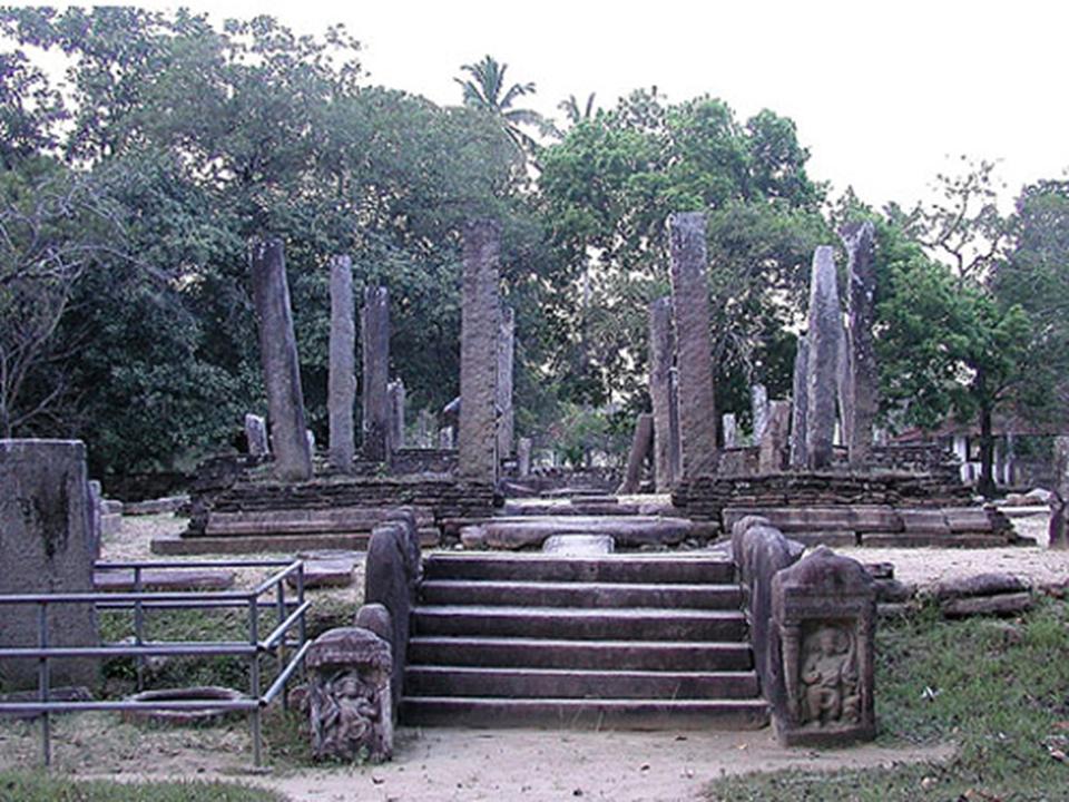
WILGAM RAJAMAHA VIHARAYA
Velgam Vehera is located around 15 km away from Trincomalee by the Trincomalee - Anuradapura Road. According to the historical facts, the Vegam Rajamaha Viharaya was done by king Devanampiyathissa. Later on some additions and renovations were done by first Bathiya, Second Agkbo, first Vijayabahu and first Parakramabahu. The most important point is this temple was that this was warshiped by both Sinhala and Tamil Buddhist. That is one of the reason that Vilgam Vehera was not destroyed by south Indian Chola invasions in 10th century.
This temple was abandoned after Anuradapura and Polonnaruwa kingdoms, because people migrated to south part of the country. In the recent past, this area was under LTTE threats and very less people aware about this place. Some renovations happening nowadays and this will be become popular among the devotees coming from the other parts of Sri Lanka. This places is under threat because of the treasure hunters. You can contribute the Velgam Rajamaha Vihara Fund, and the income is exempted from the government tax. (Distance - 11 km from Trincomalee Town)
SASTRAWELA MANI NAGA PABBATHA VIHARAYA
Currently the village of Sastrawela is a tiny speck of habitation situated on the Panama-Pottuvil Road. The village does not even make it into the Survey General’s map. Since the 1980’s many of its inhabitants have fled to Panama due to the unrest in the area. Yet back in the hay day of the Ruhunu Kingdom, Sastrawela was not only well known, but it was considered as an important seat of learning. According to folklore, the name Sastrawela is said to have been derived from the original name Shastraweiliya which indicates that the locality was associated with an institution of learning. The word ‘Shastra’ even roughly means a discipline or an art form. The area is said to have been the abode of many a soothsayer and scholars during ancient times. Legend says that scholars from far away kingdoms and even across the seas from India had travelled to Sastrawela to learn the various disciplines of science and astrology.
The relevance of Sastrawela to the story of Prince Gamini is the fact that it is said that the astrologers that were occupied at the Royal Palace of King Kavantissa hailed from this village. When the royal wedding between the King of Ruhuna, Kavantissa and his bride Princess Vihara Maha Devi was to take place, the astrologers of Sastrawela were consulted to obtain the auspicious times for the various wedding rituals. It is said that after considering the horoscopes of the royal couple, the learned men at Sastrawela determined the auspicious times for the many rituals involved in the marriage of the royals. (Distance - 83 Km from Ampara Town)
SENANAYAKE SAMUDRAYA
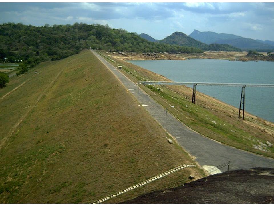
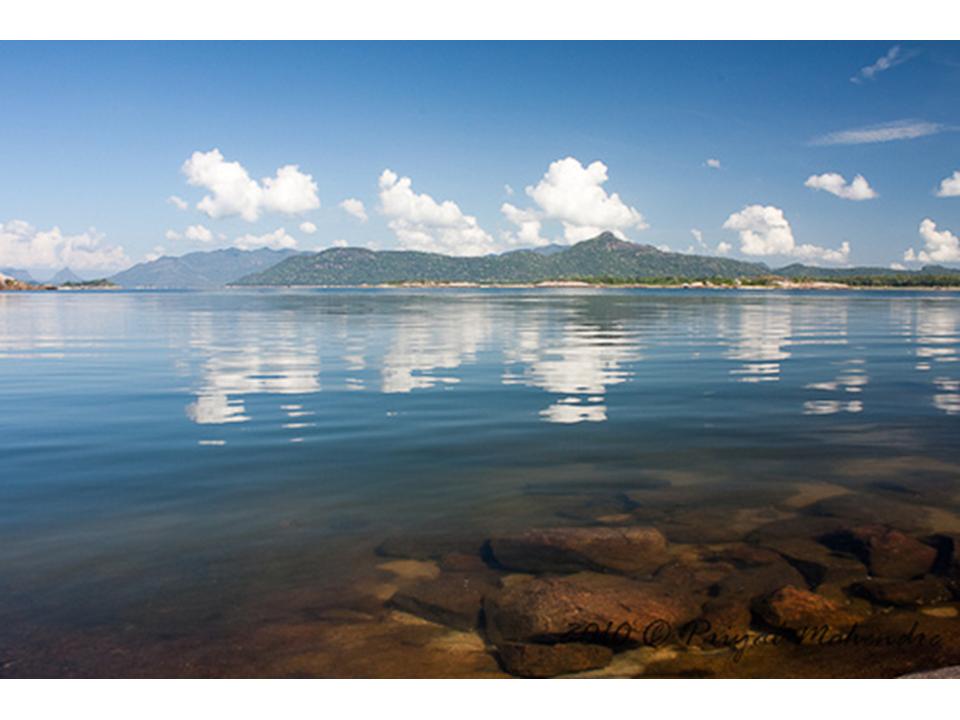
Senanayake Samudraya is a source of water for irrigation, domestic use and fisheries activities. Under the Gal Oya Development Scheme, which began in 1949, the valley area around the park has been developed for agriculture. Paddy cultivation takes place both during the Yala and Maha seasons, and around 4,000 ha of the right bank is under sugarcane cultivation. (Distance - 12 Km from Ampara Town)